

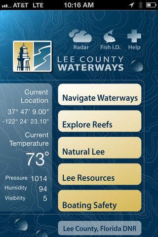


This is a must-have app for boaters in Lee County, Florida! Its packed full of great features like an interactive map with public boat launches, reef and shipwreck coordinates and speed zones. It also includes a saltwater fish identifier, satellite weather radar, fishing and diving tips, boating safety regulations and more. So before you launch your next excursion, launch our app and get the most out of Lee County Floridas waterways!
• GPS navigation from multiple launch sites
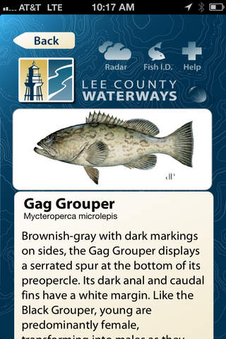
• Saltwater Fish and Special Species Identifier
• Artificial Reef and Shipwreck Maps
• Satellite Weather Radar
• Fishing and Diving Tips
• Boating Safety Regulations